
Panorama of the western approaches to Jerusalem

Start point: Sataf Forest
Finish Point: Lifta Spring, and the entrance to Jerusalem
Section Length: approximately 14 Km
Elevation
Starting point: 600 m
End point: 800 m
Lowest point: 545 m
Trail sign: Blue

Section Map
For reasons best understood by Google, unlike the Israel Trail, Google has not as yet marked the Jerusalem Trail on its maps.
However, when Google disappoints there are other alternatives. (Click on the + sign in the picture to expand the map).
For the record…
Just like in the Israel Trail blog, this is not intended as another “From A to B” blog about the Jerusalem Trail, but rather, an opportunity for me to share with you, my readers, a personal glimpse at some of the sites, along with my perspective and thoughts about the route.
The Jerusalem Trail - Day One Part 2:

Back to the Trail, the Beit Zayit Reservoir
A bit further on, the black trail heads to the left, towards Mevaseret Yerushalayim, but we continue our descent on the blue trail. Further down, the trail splits right towards the Beit Zayit reservoir, but we stay on the left, following the blue trail towards another section of Nahal Sorek. From the trail, we have a good view of the reservoir, which fills to various degrees with rainwater only in the rainy winter months and is dry the rest of the year. We can also see the Beit Zayit fields and old, by now familiar, watchtowers.
Motza and Highway 1
Another few steps and the trail makes a sharp turn left towards Motza Ilit, and then Motza and its winery are before us. Established in 1854, Motza was the first Jewish farm founded in the modern era in Israel. The pastoral setting of Beit Zayit and Motza makes it hard to believe that we are so close to a major city.
When the path dips, a sign warns of possible flash floods in the winter. Winter rains are long behind us, but the stream bed is full of pebbles here, evidence that the sign is no joke.

We are now under the old Highway 1 bridge, built by the British to replace an even earlier bridge destroyed by the Turks in World War 1. The bridge has recently been widened to create extra lanes for the expansion of the Jerusalem-Tel Aviv highway. From the underpass we can hear the rush of traffic above us. The busy highway bears no resemblance to the narrow, tortuous road from seventy years ago, but along portions of the road the shells of old, plated vehicles used in the Jerusalem convoys bear witness to a time that is long past, but not forgotten.
Nahal Sorek and Nahal Halilim
Along the dry stream bed, ancient olive trees and almond trees mark the approach to Khirbet Beit Mizu. The site was once considered a likely possibility for the location of the biblical Motza. Recent archeological finds, however, have placed the biblical settlement higher up the mountain, in the old Arab village of Kolonia.
The use of “Colonia” for Motza appears in the Talmud. The name is a reference to the colony built in Motza by the Roman emperor Vespasian for veterans of the Roman Tenth Legion, the unit responsible for the conquest and destruction of Jerusalem. Among the findings in the area are Jewish burial caves and winepresses carved from the local stone, a mikve (ritual bath), and ruins from the Byzantine period.

The burial caves dating from the first temple period are, unfortunately, not as well preserved as the winepresses and burial caves here that date from the second temple period.
From the southern side of the valley, we can see the openings to the Halilim cave, formed by the erosion of the local limestone by rainwater. The name stems from the sound of the wind blowing through the cave, which is said to imitate the eerie, ghostlike sound of flutes, halilim in Hebrew.
The ever-present train bridge soars over us, but at times I wonder if it isn’t more of a hulking presence. Will this manmade intrusion into the natural scenery interfere with the quiet once the train line begins operation?
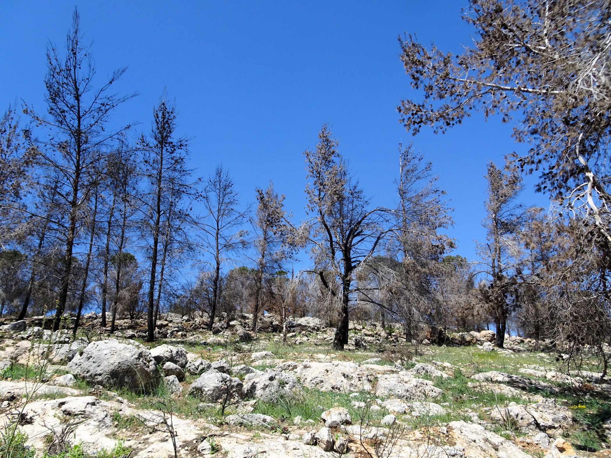
There are more well-preserved agricultural terraces built centuries ago to protect the topsoil from being washed down the mountainside. Grapes grow there, as well as olive, pear, almond, and fig trees, remnants from old orchards.
A bit further we can see an abandoned two-story building to our right. We have arrived at Enot Telem.
Time for a well-deserved rest and, for my readers, a small gallery of pictures, below. (Click on pic to enlarge)


Enot Telem (Telem Springs)


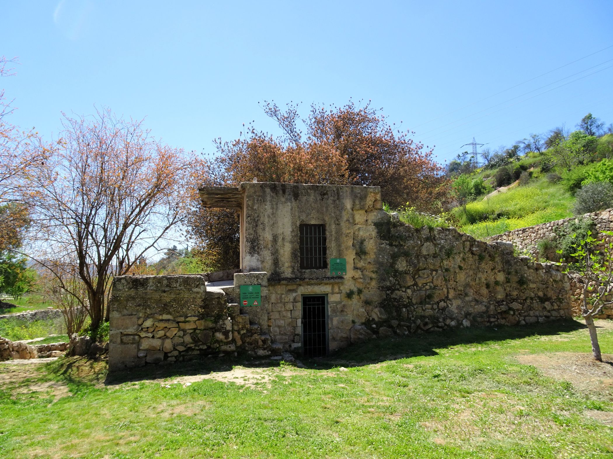
The Telem Springs are three springs which stem from the convergence of Nahal Luz, which flows from the north, and Nahal Sorek. One of the springs is hidden by a Mekorot pumping station, another is actually a man-made well. The main spring is reached through a walled in yard in which figs, pomegranates, and grapes grow. Near the two-story building is a collection pool covered with a growth of duckweed.

Around the spring are the remnants of a small Jewish settlement from 1906, built on land purchased by two of the founders of Rehovot, Aaron Eisenberg and engineer Dov Klimaker. . The men envisioned the settlement, which they named Beit Talma, as an agricultural-industrial community. To this end, they planted olive trees and began the construction of the two story building, which was intended to serve as a soap and oil factory. The secluded setting and other difficulties led to the abandonment of Beit Talma. In 1922, five Jewish families arrived intending to resettle the site, which they renamed Emek HaArazim (Cedar Valley).
And why "Cedar" Valley?
Herzl’s Cedar
After travelling to Jerusalem for an audience with Kaiser Wilhelm II, Herzl was invited by a young farmer to visit the settlement of Motza, located just a few miles west of Jerusalem. By the time of Herzl’s visit in 1898, Motza was still the only Jewish settlement in the area, although by the time of Herzl’s visit, thebut in the forty-four years since its inception, the four original families had grown into a community of some 200 people. In Motza, farmers worked fields, vineyards, and olive, date, and apricot orchards. Motza also had a tile factory and a traveller’s inn that served as a convenient stopover for pilgrims headed to or from Jerusalem.
Herzl was struck by the contrast between the barren Judean Hills he had travelled through and the lush green paradise he found in Motza. Towards sunset, the visionary rested in the shade after his warm reception and tour. As the sun descended towards the sea, it lit the hills in an array of beautiful colors and inspired Herzl to action. He announced to his entourage that he would plant a tree at that location, and indeed, climbed the mountain to plant a cedar. In honor of the cedar (erez) planted by Herzl, the area was called by the feminine form of the word, Arza. Even though it later turned out that the tree planted was actually a cypress, the name remained.
When Herzl died five-and-a-half years later at age 44, his cedar had already grown into a tall symbol of Herzl’s vision of the Jewish resettlement of Israel. Every year after that, Zionist youth marked the anniversary of his death (the twentieth of Tammuz—usually late June or July) by ascending that same hill to plant more cedars and cypresses around Herzl’s tree.
However, when true to their custom, young Zionists returned to the tree in 1917 during World War One, they found the tree chopped down. They gathered the cones they found scattered around the site and saved the remnant of the trunk. The rescued tree stump became an important symbol, and after the defeat of the Turks later that year, seeds from the cones were planted to produce new trees in the area and throughout the country.
And so, the symbol of the cedar remained and was adopted as the name of the revived settlement at Ein Telem, and also as the name of Israel’s first medical sanatorium, Arza , built at the site where Herzl planted his tree.
In the wave of Arab riots that erupted throughout mandatory Palestine in August 1929, both Emek HaArazim and Motza were similarly cut down. Although none of the attempts to resettle Emek HaArazim took root, four years after the 1929 riots and massacres, Motza Ilith (Upper Motza) was established further up the same hill, near its original location.


From the Telem Springs, we proceed to a paved road to the east of the springs that leads to an impressive 9/11 Twin Towers memorial.

The 9/11 Living Memorial Plaza
Planned and designed by landscape architect Yehiel Cohen and artist Eliezer Weisshoff, the monument was funded by the Jewish National Fund through donations from American supporters. Construction was completed hours before the dedication in 2009.
The structure was conceived as a means of commemorating the victims of the 2001 terror attack in New York City while serving as a tangible reminder of the ties between America and Israel, and the shared values of the countries’ citizens. It is the only non-American memorial to include the names of all those killed in the attacks.
The bronze sculpture at the center of the plaza shows a windblown American flag which transforms into a metal memorial flame reaching thirty feet (about nine meters) into the sky.
The monument was fittingly constructed facing Jerusalem’s main cemetery, Har HaMenuhot, and will be visible to those travelling by train to Jerusalem on the soon to be finished Tel Aviv-Jerusalem line.
The moving monument in the serene mountain setting pulls at the heart strings and is a good place for contemplation.

Emek HaArazim Park
As we ascend towards Jerusalem, we can see the northwestern Ramot neighborhood clearly before us. We are now in the heart of the Emek HaArazim Park, with its wealth of bicycle and walking paths, nature observation points, playground equipment, and more—all part of a project to construct a green belt around Jerusalem.
Crossing under the Highway 9 and Highway 1 overpasses, we approach an observation point which provides a magnificent view of the water channel we just hiked. From there we proceed to Lifta.
The Village of Lifta
Lifta is the Arabic name of an ancient village mentioned in the book of Joshua as part of the border between the portions of Judah and Benjamin and referred to as “Mei Naftoach” (the waters of Naftoakh) in Joshua 18:15:
ופאת נגבה מקצה קריית יערים ויצא הגבול ימה ויצא אל מעין מי ניפתוח.
… The southern side began at the outskirts of Kiriat Yearim on the west, and the boundary came out at the spring of the waters of Nephtoah.

The village is adjacent to another local perch spring which provided enough water for the agricultural and personal needs of the people who lived there. In Biblical times, villagers also sold the spring water to Jerusalem residents, who lived a bit farther away in those days. After the Islamic conquest of the area, the Jews left and the village was settled by Arabs.
In the months prior to statehood, the village, located at the western entrance to Jerusalem, was a prime location for sniper activity aimed at the road serving as the main entry to Jerusalem and at the adjacent neighborhood of Givat Shaul. During the War of Independence, several structures were bombed in retaliation, and the village was abandoned.
Although several attempts were made to resettle the village, none of them took hold. And yet, year round, the picturesque setting and fresh water attracts visitors of all ages. Some come with flashlights to walk through the opening in the rock face to explore the water source; others come ready to dip in the collection pools, or to explore the buildings with their beautiful architecture and hidden treasures: arched windows, ancient olive presses, stones from the Holy Temple, recycled to serve as building material.
But be careful: some of the buildings are in danger of collapse and are marked as such.
Given the setting, it should come as no surprise that many student films have been filmed here.
The place also attracts artists, the homeless, and many colorful figures.
Irrigation channels line the path leading from the village to the collection pools. Water still flows through them to nourish the fruit trees in the surrounding gardens.
Bits of litter poke through the green duckweed that covers the large lower collection pool. It’s jarring after the haunting stillness of the ruined buildings. Fresh water pours out of two openings in the stone wall at the edge of the pool. The water here attracts no one, only flies. The crowd can be seen one level further up.
A few more steps and we’re up at the upper level, where the action is. Groups of people, mainly children, fill the upper pool and watch from the sidelines. Water constantly gushes in to the pool from an opening that extends from beneath the entrance to the spring’s source.
But our day is coming to an end and it’s time to leave. We traipse up a well-worn path, finally catching a sign of habitation in one building on the mountain side.
I turn around for one last glimpse at the village below us and catch sight of Jerusalem’s sprawling northwestern neighborhood of Ramot facing the Arab village of Beit Iksa. On a mountain top between the two, I can make out Nebi Samuel, the Prophet Samuel’s final resting place.


One last moment of quiet, and suddenly we are back in the modern world, caught between the traffic on the Begin Road and the entrance to the city. Some stairs lead us to an unidentified sculpture, and then to a pedestrian overpass leading us over the Begin Road and to the gas stations at the entrance to Jerusalem.
A little further uphill is Jaffo Road and the Central Bus Station, across from us is the Chords Bridge, designed by Spanish architect Santiago Calatrava. The bridge, dedicated in June 2008, was constructed to accommodate pedestrian traffic as well as Jerusalem’s light rail
We get only a small peek at the Jerusalem view, but the day is over. It is time to say our goodbyes, until we meet again for the next segment of the Jerusalem Trail.
Comments
With Public Transport:
Either 31/32 Busses from outside the Central Bus Station in the direction of Ramot (Or from downtown Jerusalem bus # 72). Get off at Zondek/Nelson Glick (about 10 minutes). From there it is a 35 minute hike.
By Car:
Get onto the Golda Me’ir Boulevard (Route 436) – southbound. When you approach the Golda Me’ir Interchange there is a slip road to the right – signposted 9/11 Living Memorial Site (signpost white on brown) – from there just follow the signs.
On Foot:
From the entrance to Jerusalem (Givat Shaul Interchange) walk west past the PAZ Gas Station. Turn right and walk down Nefto'akh St to Lifta. Signposted from there. (45 minute hike downhill – about 60 minutes going back).
NOTE: You can combine options 1 and 3.
Enjoy!!
Thank you for your informative blog.
Thank youI will be in Jerusalem next month. Can you please tell me how best to get to the 9/11 Memorial site there.